I thought it would be interesting to look at the maps of the Inner Harbour of Victoria from 1846 to 1949 so you can see the changes over time. I am a total geek for maps and love the fact so many of the old ones are now available online.
 |
| 1846 map of the Inner Harbour - notice fort on the map, also the Gorge was called Condordia Arm |
 |
| 1847 - this is mainly a navigation map, but you can see the buildings of the fort |
 |
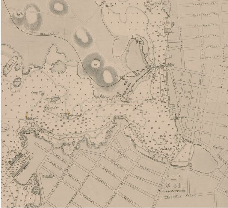
1862 - the city is now laid out and on the bottom you can see the Bird Cages
By this time we have a bridge over James Bay and a bridge crossing where the Johnson Street Bridge is now |
 |
| 1895 - the railway arrives but other than that I am amazed at how similar this is to the 1862 map |
 |
| 1907 - the big change is that James Bay is filled and there is the CNR wharf on the inner harbour |
Upper Harbour in 1907
 |
| 1921 |
 |
| 1921 - the upper harbour area |
 |
| 1949 - what I find interesting in this map is the expansion of the railways downtown |


1 comment:
Great images, I love maps too. Feel free to post more images (may I suggest aerial?) of this great city!
Post a Comment